

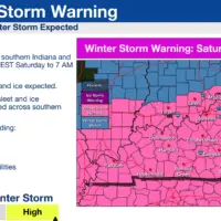
A “Winter Storm Warning” has now been issued for the area from early Saturday (1/24) morning into Monday (1/26) morning.
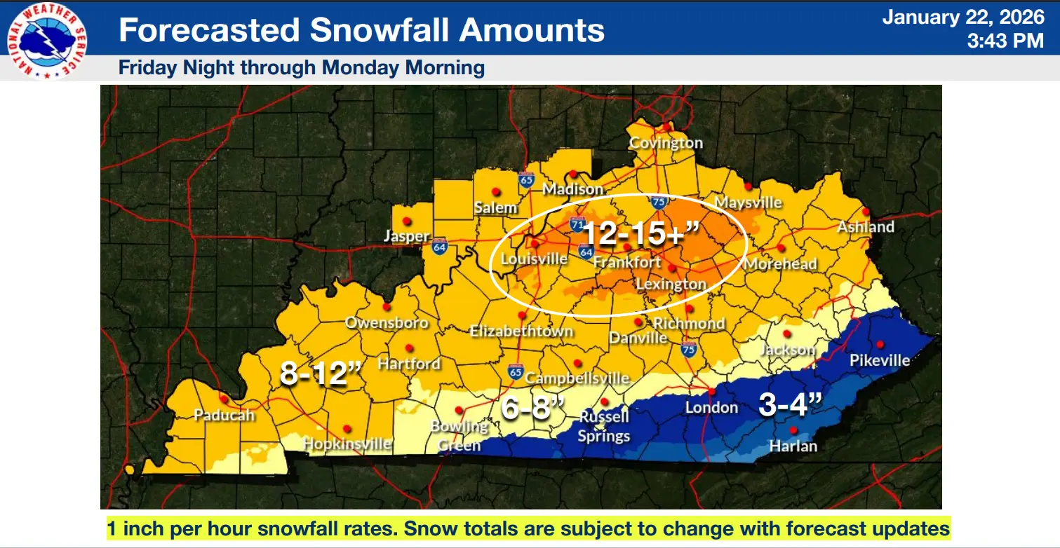
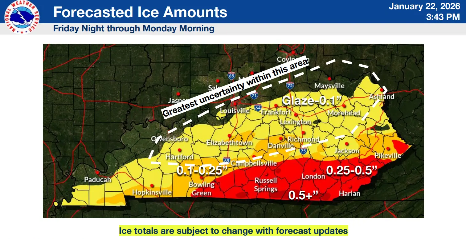
A developing storm system has the potential to bring heavy snow and a mix of sleet and freezing rain to the area this weekend, making travel difficult to near impossible. Snow accumulations range from 8 to 12 inches with locally heavier amounts possible. The as of 3 PM CST 1/22/26…
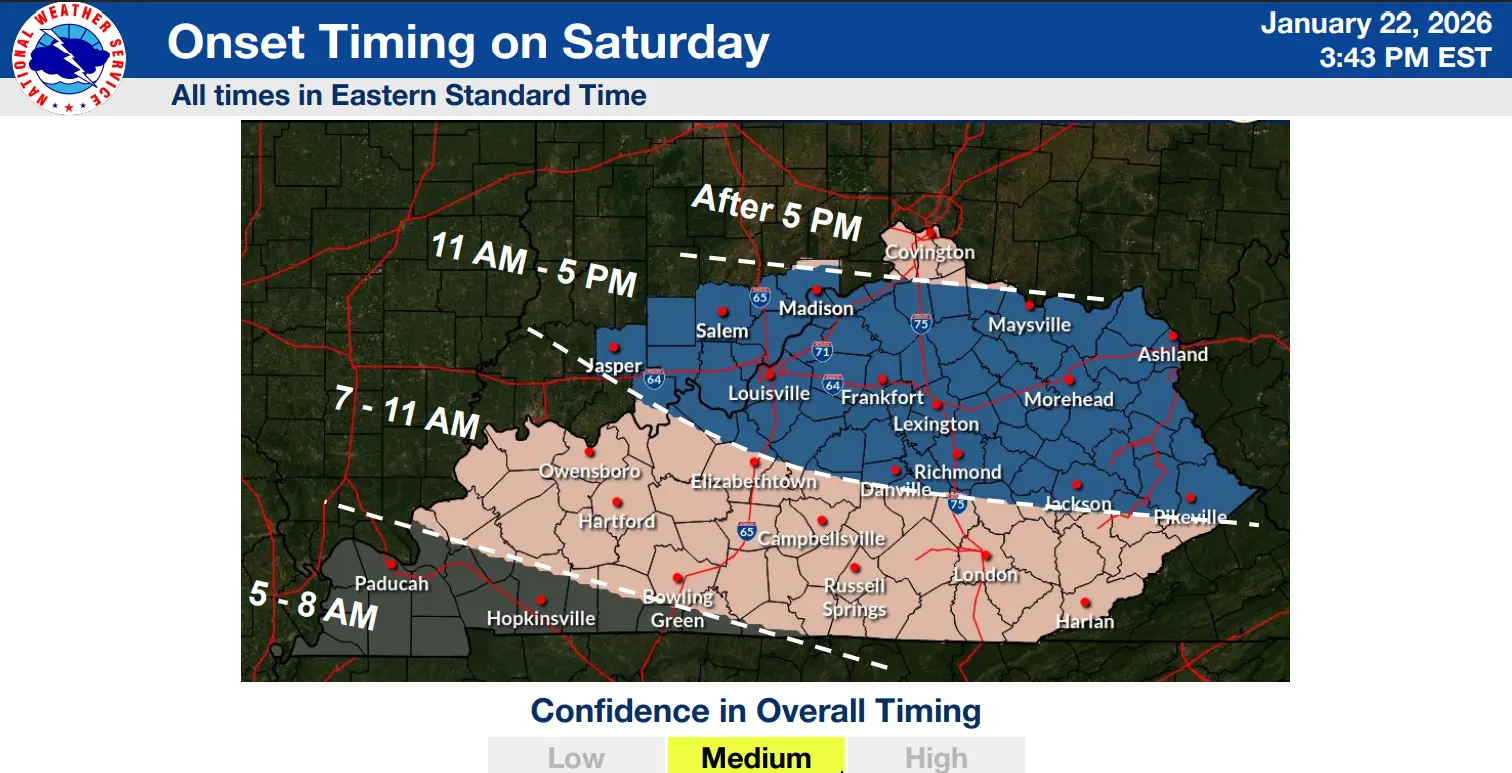
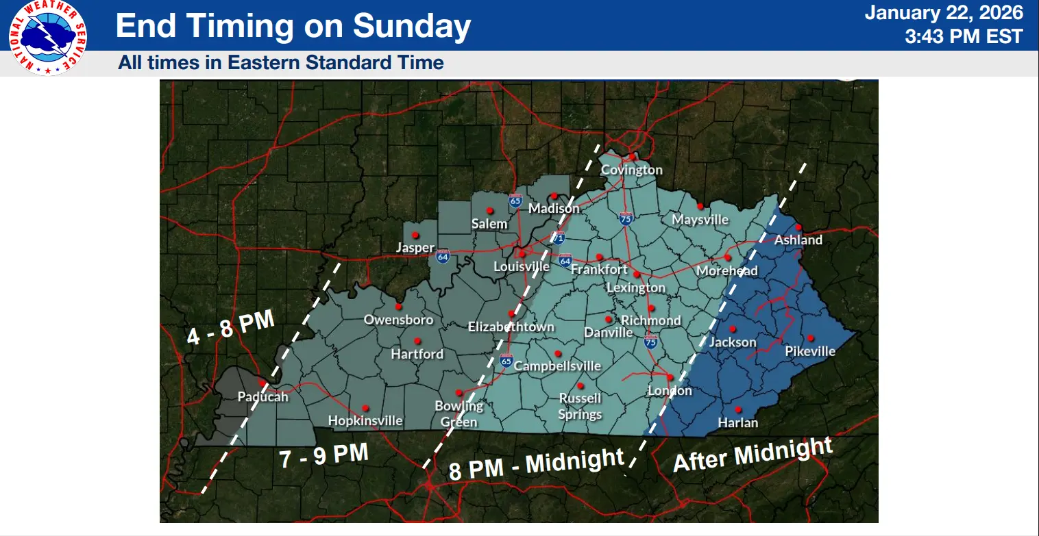
Storm timing: Mid to late morning (6 A – 10 A) Saturday (1/24) until Sunday evening (7-10P).
Uncertainty remains about how far north the sleet and freezing rain line will push into our area. Accumulations of sleet or icing will impact snow totals.
After the storm moves out, extremely cold temperatures for the first part of next week. Some temperatures ae expected to be at or below zero with wind chills near -10 to -15 Monday & Tuesday.
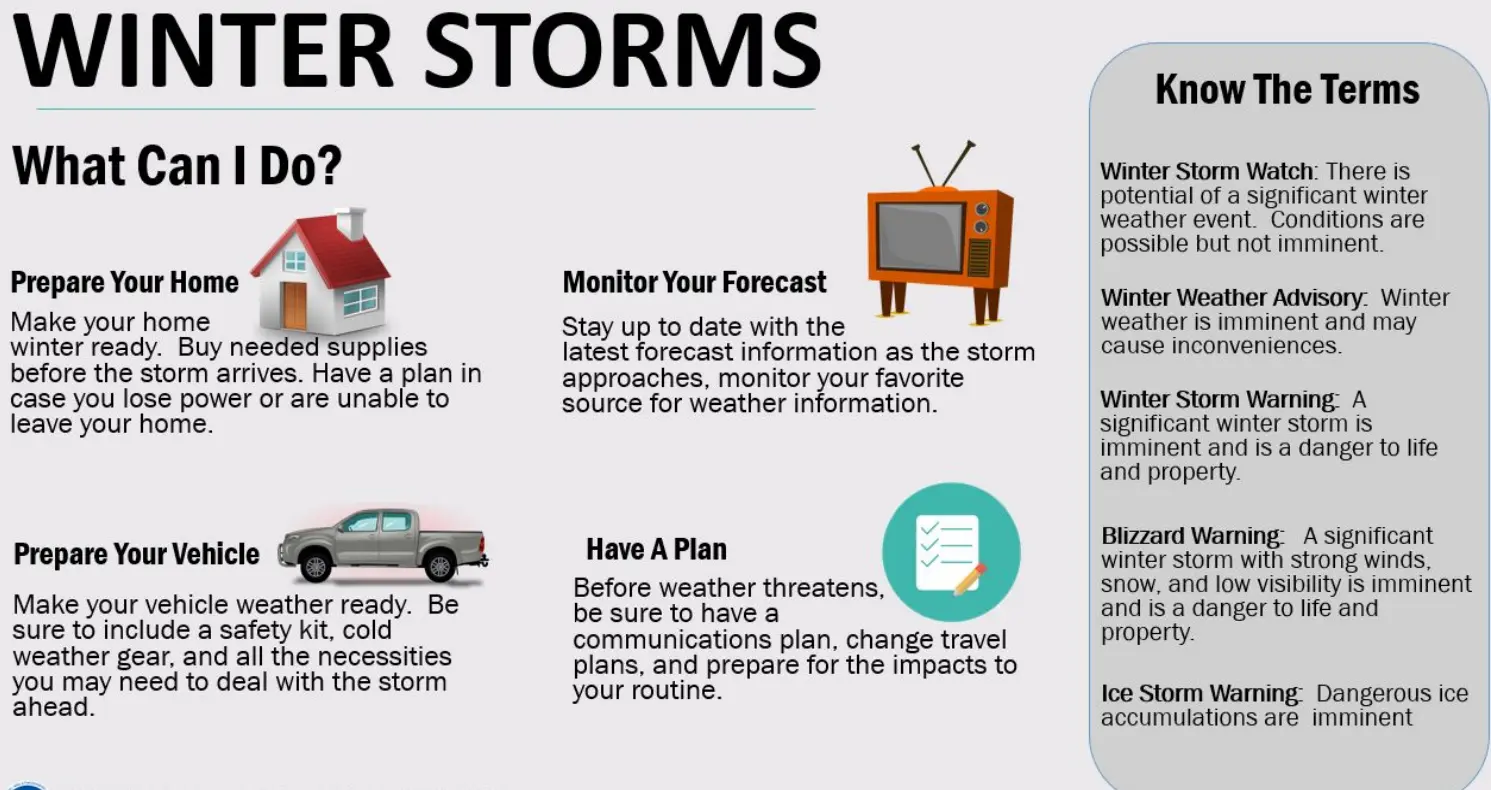
Stay with WXBC for the latest on the weather.